Actual maps of Montreal city
Map of borough Downtown (PDF) »»
Map of borough Côte-des-Neiges - NDG (PDF) »»
Map of borough Rosemont (PDF) »»
Map of borough Outremont (PDF) »»
Map of borough Plateau Mont-Royal (PDF) »»
Map of borough Ahuntsic / Cartierville (PDF) »»
Map of borough Villeray / Saint-Michel (PDF) »»
Map of borough Hochelaga-Maisonneuve (PDF) »»
Map of borough Lachine (PDF) »»
Map of borough Verdun (PDF) »»
Map of borough Saint-Léonard (PDF) »»
Map of borough Westmount (PDF) »»
Map of borough Saint-Henri / Petite-Bourgogne (PDF) »»
Arrondissement Rivière-des-Prairies Pointe-aux-Trembles (PDF) »»
Arrondissement LaSalle (PDF) »»
Arrondissement Le Sud-Ouest (PDF) »»
City of Côte-Saint-Luc (PDF) »»
Map of borough Saint-Laurent (PDF) »»
Arrondissement Anjou (PDF) »»
Official Tourist Traveler Map (PDF) »»
Detailed Map of Underground Montreal (PDF) »»
Detailed Map of Underground Montreal by STM (PDF) »»
Detailed Map of Underground Montreal RESO (PDF) »»
Map of cycle path in Montréal and suburb (PDF) (PDF) »»
Montreal Bike Paths (PDF) (PDF) »»
Parc Jean-Drapeau Park plan (PDF) »»
AMT (PDF) »»
Université de Montreal Campus Map (PDF) »»
UQAM Campus Map »»
Map of Montreal and suburbs Highways (PDF) »»
Old-Port of Montréal plan (PDF) »»
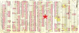
Atlas Montreal 1914 »»
Atlas Montreal 1939 - Plateau - Mile End »»
Atlas Montreal 1940 »»
Atlas Montreal 1951 »»
| Montreal and its fortifications in 1760 ,by Bennett. |
 |
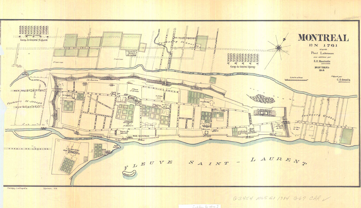
| Montreal and its fortifications in 1761 by Paul Labrosse (Made in 1914) |
 |
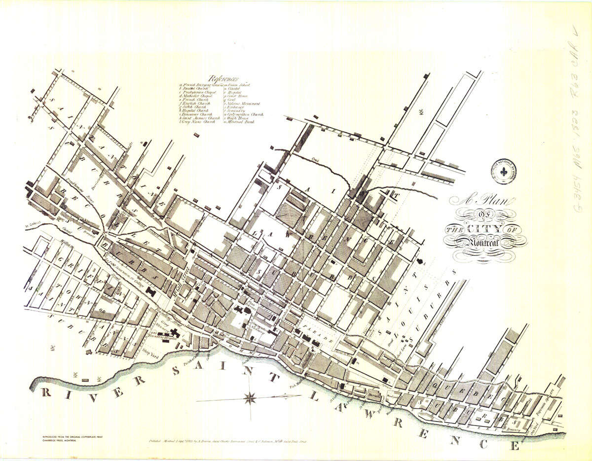
| 1823. |
 |
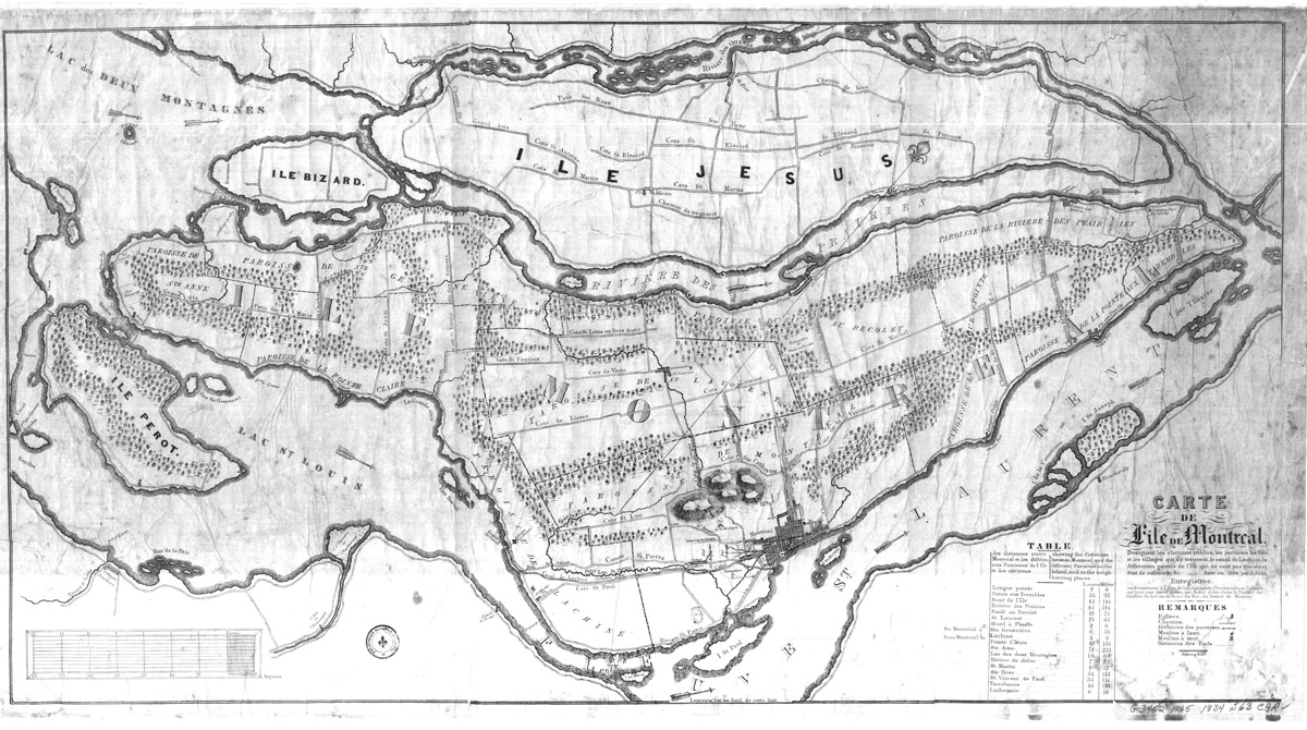
| Montreal island in 1834 by André Jobin. |
 |
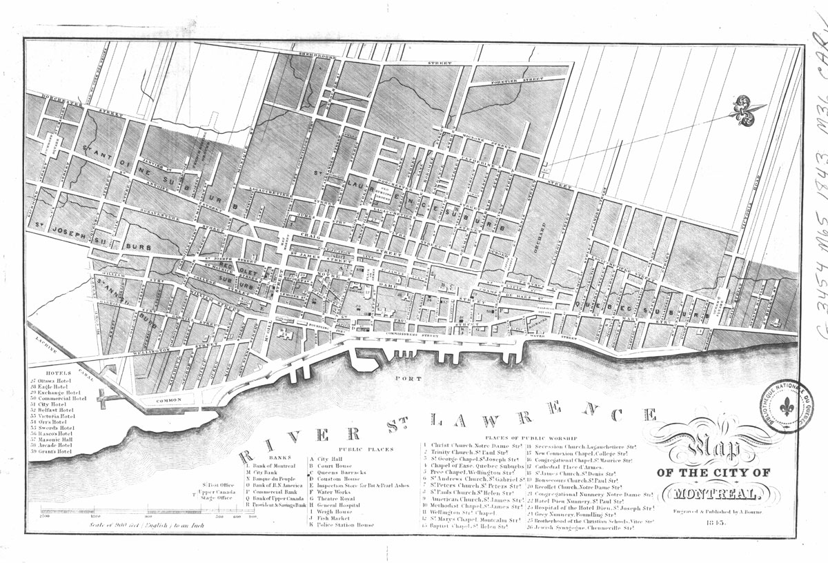
| 1843. |
 |
| 1859. |
 |
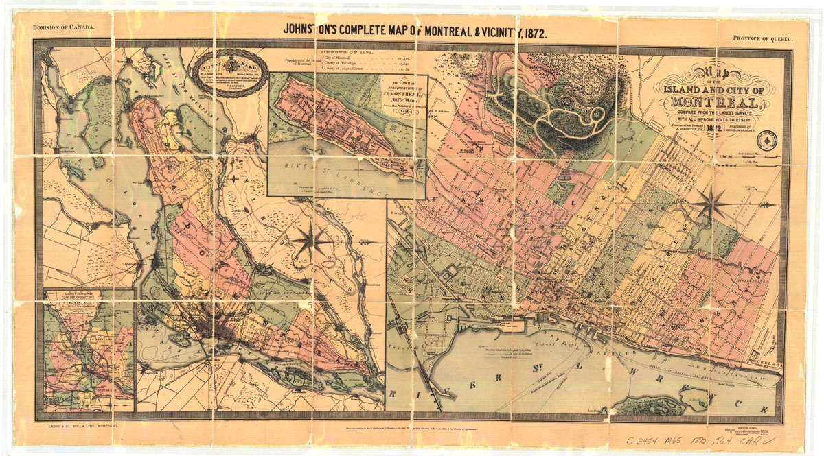
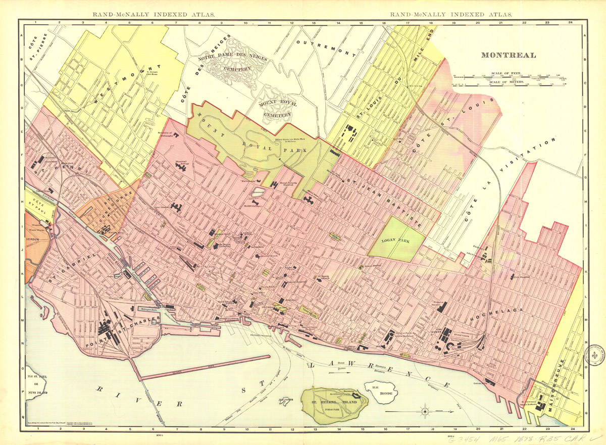
| 1872. Montreal city and its suburbs |
 |
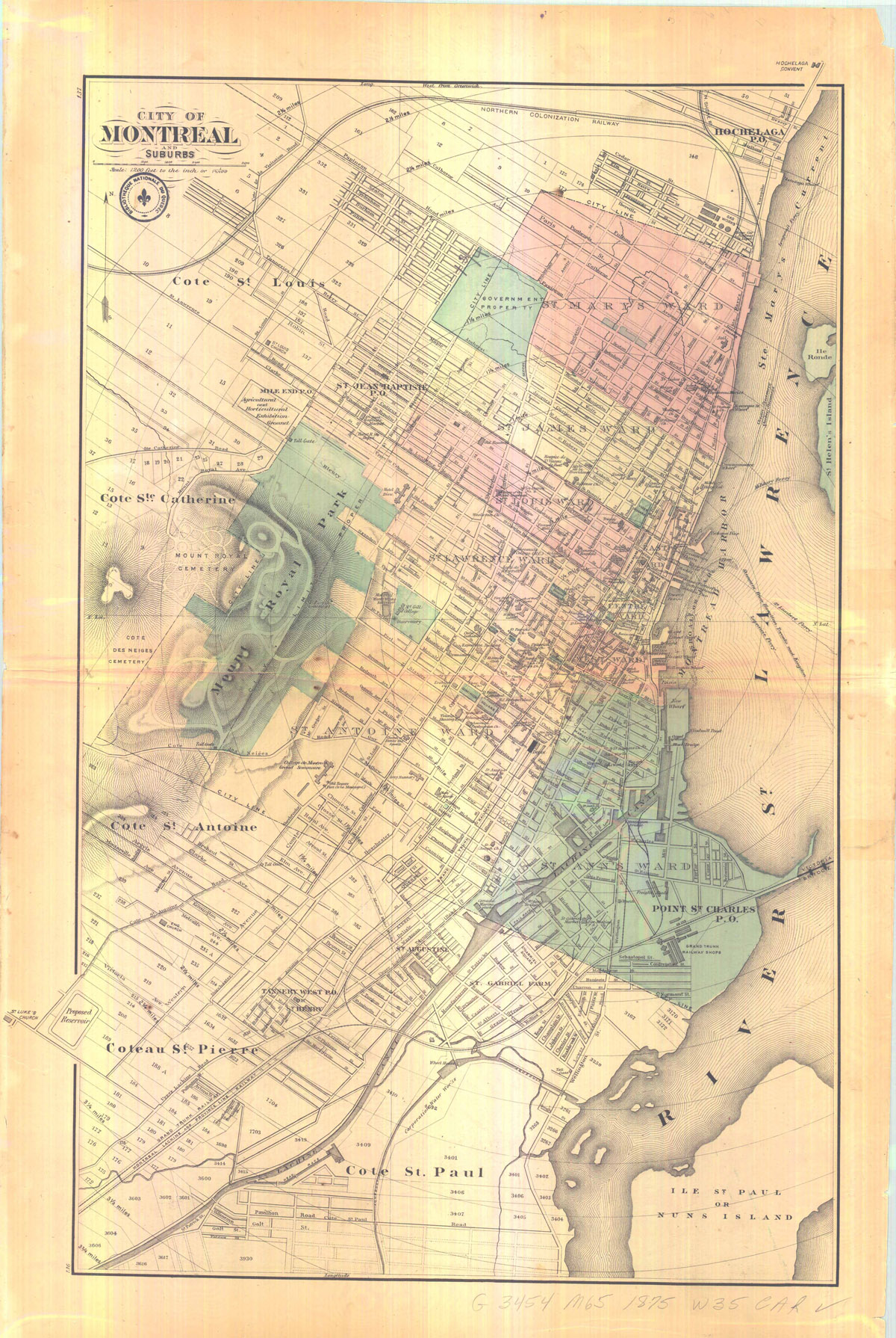
| 1875. |
 |
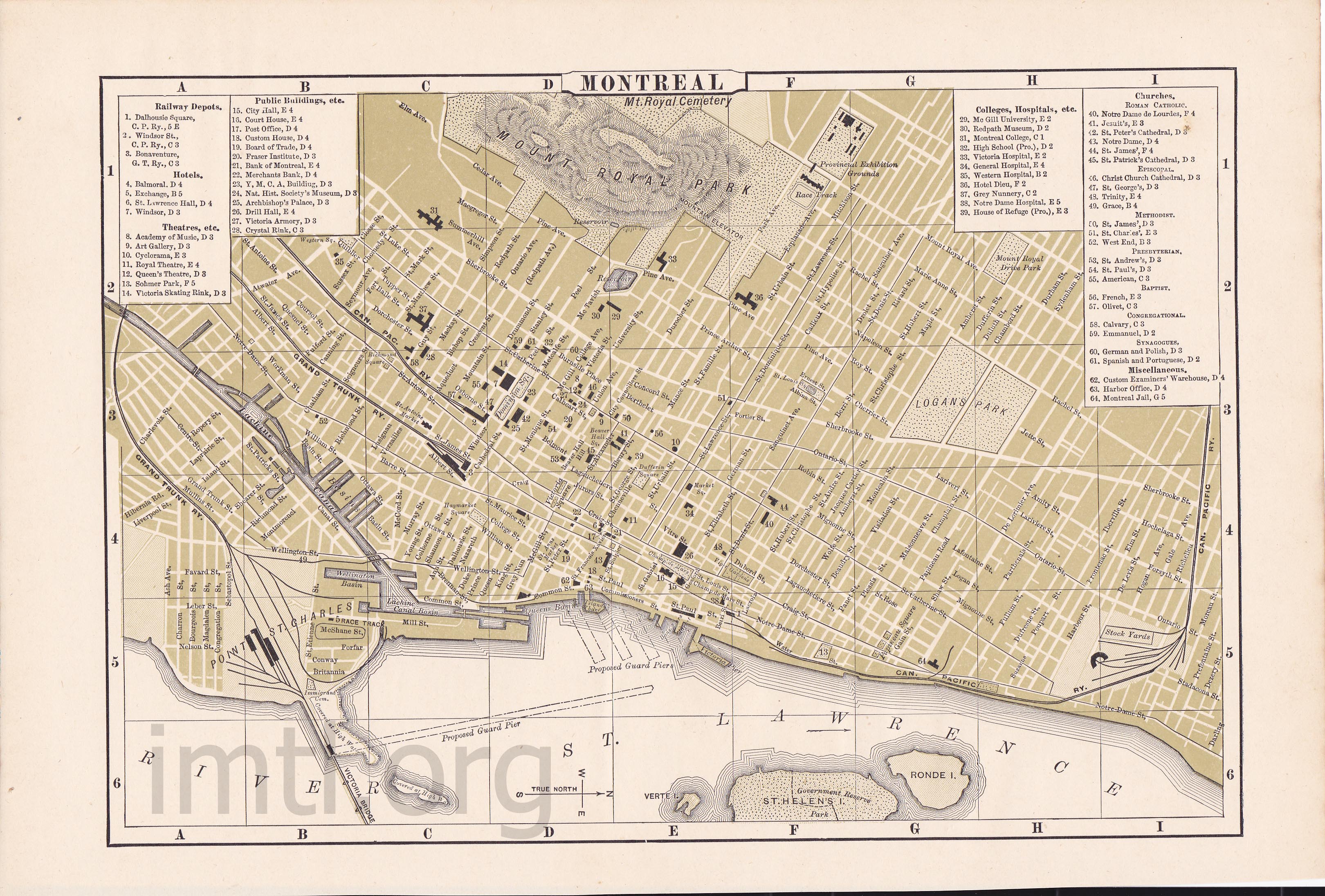
| 1894 |
 |
| 1898. |
 |
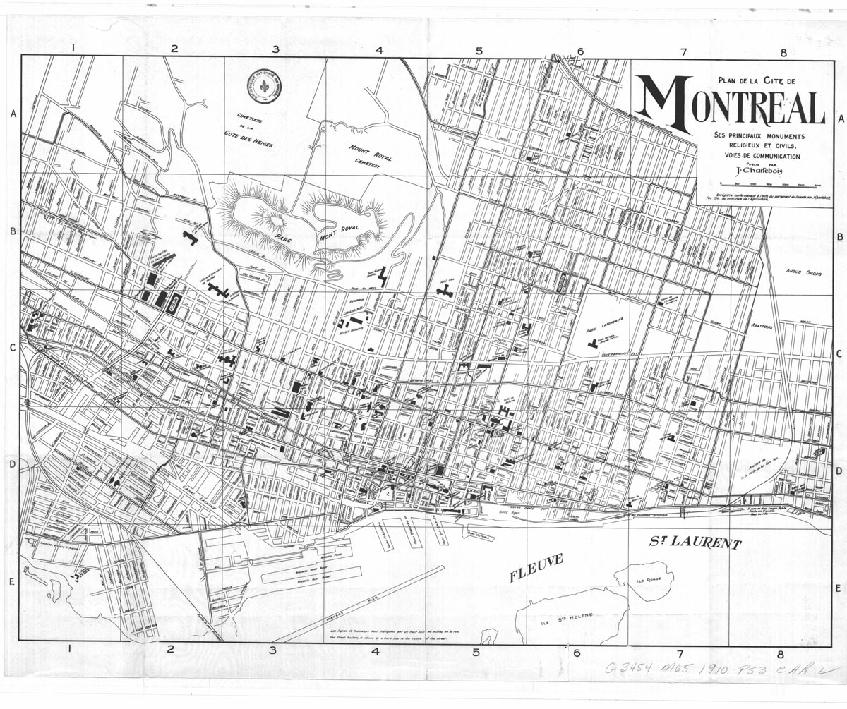
| Main civils and religious monument in Montreal city 1910 |
 |
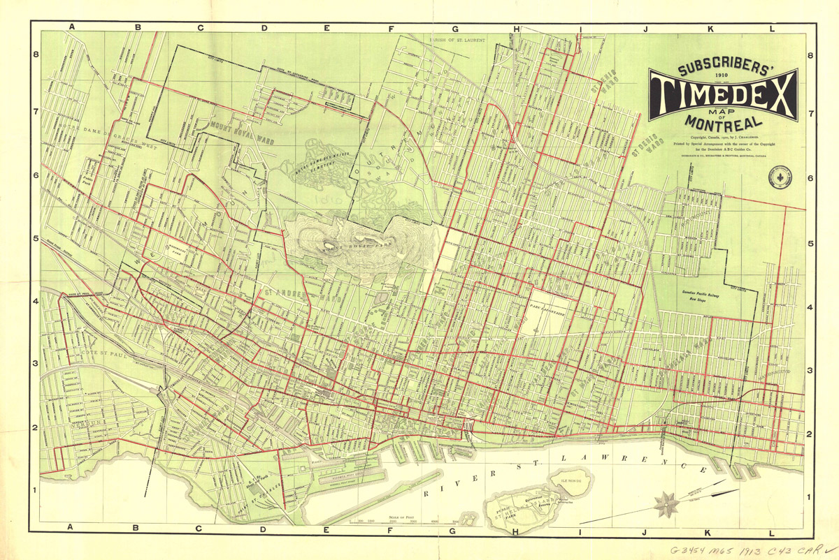
| 1913 Timeindex suscriber. |
 |
| 1929 Compagnie des Tramways de Montréal. |
 |
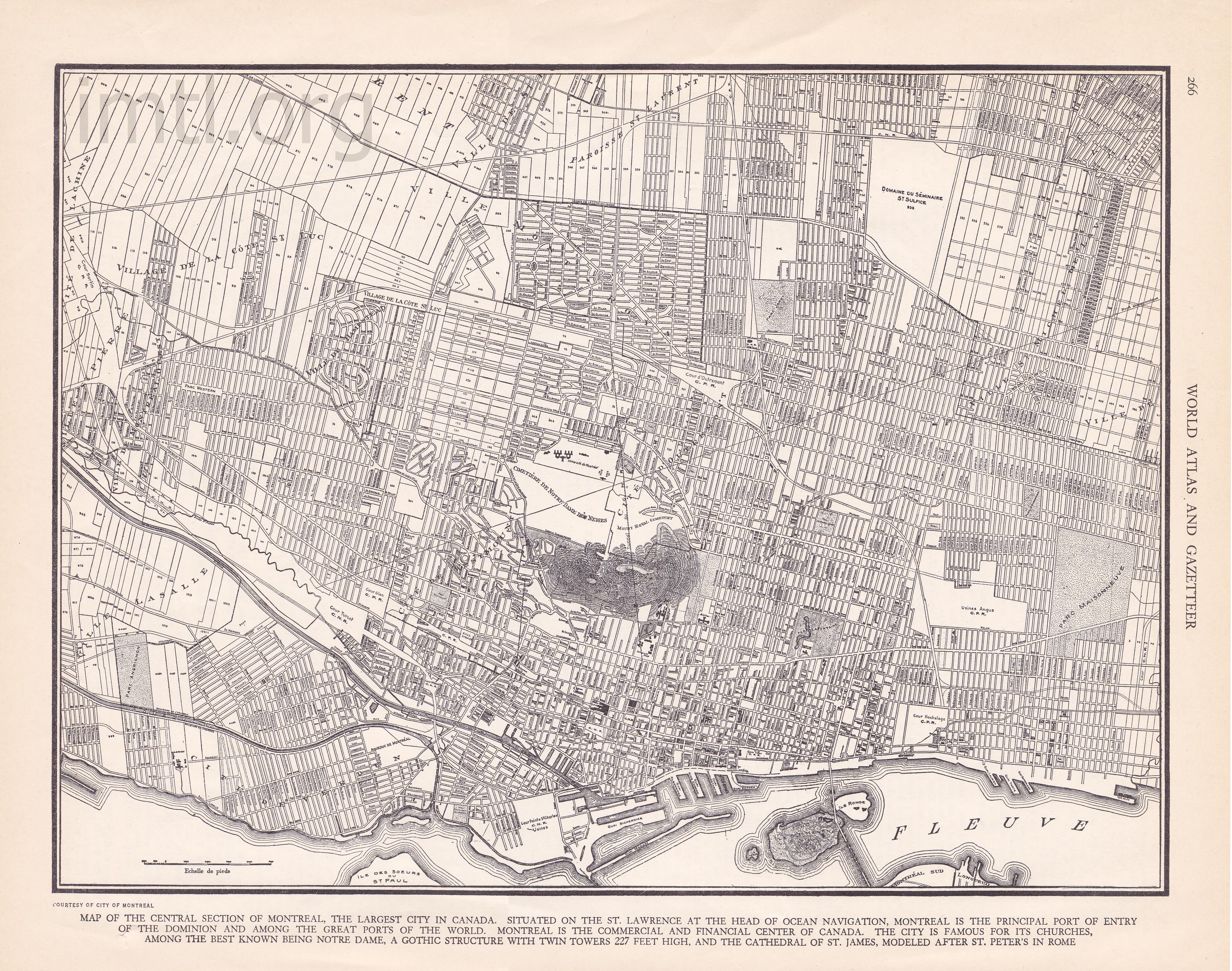
| 1939 (World Atlas and Gazetter) |
 |
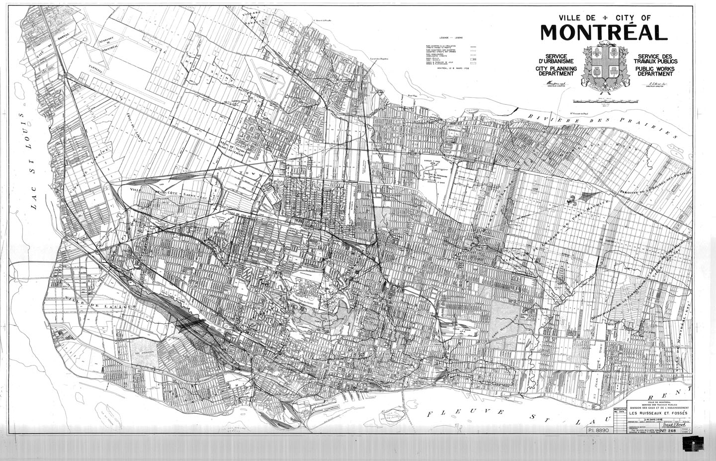
| 1959 Ville de Montréal, Les ruisseaux et fossés |
 |


All buildings on a map

3D barchart of skyscrapers

35 maps & links

88 virtual exhibitions
200 historical maps